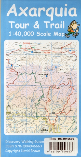
Axarquia (Costa Del Sol) Tour & Trail Map Sheet map, folded
by David Brawn
Edited by David Brawn
Illustrated by David Brawn
Part of the Tour & Trail Maps series
Sheet map, folded
Description
This map is being replaced by a new Costa del Sol (Axarquia) Tour & Trail Super-Durable Map in April 2017 along with a new Walk!
Costa del Sol (Axarquia) guide book expected to be published in May 2017.
Large 40,000 scale double sided topographical map specifically designed for car drivers and walkers exploring the Costa del Sol's premiere mountain landscapes.
Digital editions of this map are available for use on mobile phone apps from Viewranger, Memory Map and MyTrails, plus versions for mapping gps units and gps software are available from Mapyx Quo and Memory Map.
Size 840mm by 720mm flat folded to 240mm high by 120mm wide, includes generous overlap between sides to reduce 'map turning' while navigating. You'll easily see why our Tour & Trail Maps are so popular when you compare them with other maps.
Our design emphasises the things you see when driving (roads) or walking (tracks and trails) which seems the sensible way to design a map that will be good for practical use.
Tour & Trail gives clear road numbering (so you know which road you are on) along with kilometre markers (so you know where you are on that road). Miradors, cafes and picnic area symbols are places where you can pull off the road to take a break; and of course roundabouts and petrol stations which are vital for all us hire-car drivers new to the region.Off the main tarmac roads our comprehensive gps ground survey gives you those narrow lanes (camino rurals - tarmac or concrete) plus we've divided the dirt roads into 'Roads' - which are graded and rolled plus being regularly used by the locals - and 'Tracks' - that are often forestry tracks rather than unsurfaced roads.
We've driven these in a normal car but you might be well advised not to stray off the dirt 'Roads' and leave the 'Tracks' for 4WD vehicles. Off into the mountainous landscape on foot you'll find all of our routes from Walk! the Axarquia (2nd ed isbn 9781904946656) clearly highlighted and numbered, plus we've also detailed a lot more 'official' walking coming from locally published guides.
Whichever guide you are using Axarquia (Costa del Sol) Tour & Trail Map is your first choice for mapping. We include all the detail needed for navigating by car or on foot while trying to avoid cluttering up the map with items of debatable value. Axarquia Tour & Trail Map gives you the most up to date large scale mapping of this exciting region and you can be confident that our gps ground surveys by car and on foot have resulted in the most useful and accurate map you can buy.
Information
-
Item not Available
- Format:Sheet map, folded
- Pages:40,000 scale topographical map for outdoor adventurers
- Publisher:Discovery Walking Guides Ltd
- Publication Date:20/09/2010
- Category:
- ISBN:9781904946663
Other Formats
- Sheet map from £9.59
Information
-
Item not Available
- Format:Sheet map, folded
- Pages:40,000 scale topographical map for outdoor adventurers
- Publisher:Discovery Walking Guides Ltd
- Publication Date:20/09/2010
- Category:
- ISBN:9781904946663


