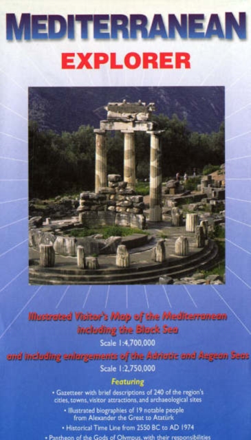
Mediterranean Explorer : Illustrated Visitor's Map of the Mediterranean including the Black Sea and Including Enlargements of the Adriatic and Aegean Seas Sheet map, folded
by Nigel Sitwell
Part of the Ocean Explorer Maps series
Sheet map, folded
Description
A fold-out visitor's map (scale 1 : 4 700 000 for the whole Mediterrean Sea and 1 : 2 750 000 for the Adriatic and Aegean Seas), that measures approximately 100 x 69 cm (W x H) when unfolded.
This travel map of the whole Mediterranean region, from Gibraltar to the Black Sea, is the perfect companion for any cruise to the area.
Concentrating mainly on its fascinating history, and especially the days of the Greeks and the Romans, the information is recounted in various ways, ranging from a series of mini-biographies of notable people, to a list of rulers, and a Timeline.
A variety of topics are discussed, such as early agriculture, trade, money, and Greek myths.
Thumbnail descriptions are given for all the ports and nearby historic sites.
In addition, a comprehensive gazeteer outlines the present-day attractions of the Mediterranean.
The map is fully illustrated with colour photographs.
Graham Speake, author of Mount Athos: Renewal in Paradise and editor of The Penguin Dictionary of Ancient History, wrote most of the text and acted as consultant for the project.
Information
-
Item not Available
- Format:Sheet map, folded
- Pages:colour & b/w photos, b/w illustrations, colour maps, scale: 1 : 4 700 000 (whole area) and 1 : 2 750
- Publisher:Ocean Explorer Maps
- Publication Date:31/12/2006
- Category:
- ISBN:9780954371739
Information
-
Item not Available
- Format:Sheet map, folded
- Pages:colour & b/w photos, b/w illustrations, colour maps, scale: 1 : 4 700 000 (whole area) and 1 : 2 750
- Publisher:Ocean Explorer Maps
- Publication Date:31/12/2006
- Category:
- ISBN:9780954371739


