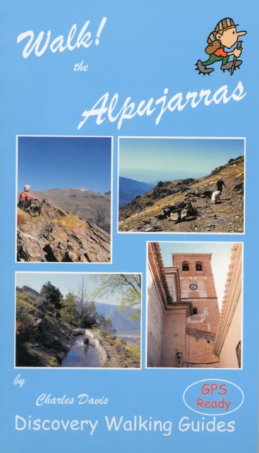
Walk! the Alpujarras Paperback / softback
by Charles Davis
Edited by Ros Brawn
Illustrated by David Brawn
Paperback / softback
Description
New for 2013 Walk! the Alpujarras is the comprehensive guide for adventurous leisure walkers choosing to explore this exciting region of Andalucia; providing many new routes along with full updating of routes from the 1st edition.
Combine with Alpujarras Tour & Trail Map 3rd edition for your complete adventure in these breathtaking landscapes.
For each of the 34 walking routes plus 5 additional alternatives there is a Fully Detailed Walk Description including Route Summary, frequent timings, colour 40K maps (Alpujarras Tour & Trail Map 3rd edition) and GPS waypoints.
Each of the 39 walking routes has a Rating Summary covering: Exertion Rating, Walking Time, Walking Distance, Ascents & Descents in metres, Vertigo warning if applicable, and a Refreshment rating. GPS waypoints ensure pin-point navigational accuracy for all the routes; the waypoint files (in gpx file format) are available for free download from Discovery Walking Guides website.
Accommodation and regional background are information included.
All of this content is written in Charles Davis' informative and inspirational style.
Walking Routes; 1 Lanjaron: PR345 Sendero Circular de Lanjaron, 3 hours, 9.6 kms, (circular). 2 Orgiva: GRs7&142 Soportujar & Canar, 5 hours, 17 kms, (circular). 3 Pampaneira: Poqueira Miradors; (a) Barranco de la Sangre via the tuberia, 2 hours, 7.4 kms, (circular). (b) SL Monte Pampaneira, 1 walker, 45 minutes, 2 kms, (circular). 4 Pampaneira: The Poqueira Villages, 3...hours, 9 kms, (figure of eight circular). 5 Pitres: Balcon de Pitres, 1A hours, 5.5 kms, (circular). 6 Pitres: Taha 1, 3 hours 20 mins, 9 kms (circular). 7 Atalbeitar: Taha 2, 2 hours, 5 kms (figure of eight circular). 8 Fondales: Sierra Mecina, 3 hours, 9 kms (circular). 9 Busquistar: Los Helechones, 3 hours, 8 kms (circular). 10 Castaras: Barrancos de Fuente Medina & Alberquillas, 1.5 hours, 4 kms (circular). 11 Juviles: El Fuerte & The Ruta Medieval (PR299), 2 hours, 5.1 kms (circular). 12 Lobras: The Balcony Loop, 2...hours, 8.4 kms (circular). 13. Berchules: SL Acequias de los Berchules, 2 hours, 6.4 kms (circular). 14. Cadiar: Grs 7 & 142 Rio Guadalfeo & Loma de Callon, 2 hours 40 mins, 11.4 kms (circular). 15. Mecina Bombaron: Waterways & Woodland; (a) PR111 Acequia de los Castanos, 1A hours, 6.8 kms (circular). (b) Sls Acequia Baja & Acequia Alta, 1A hours, 4.6 kms, (circular). 16 Lanjaron: Pena Caballera, 21/2 hours, 10.6 kms (circular). 17 Soportujar: GR240 & PR22 Acequia Almiar, 4 hours, 13.5 kms (circular). 18 Capileira - La Cebadilla - Capileira, 2.5 hours, 7 kms (circular). 19 Rio Naute Circuit, 4 hours, 9 kms (circular). 20 Acequias of the Toril Valley, 3.4 hours, 7 kms (circular). 21 The Poqueira Refuge via the Acequias, 5 walker, 5 hours, 14 kms, vertigo risk, (circular). 22 Portugos: Junta de los Rios via Molino del Sol, 2.4 hours, 6.6 kms, vertigo risk, (circular). 23 Portugos: GR240 Hoya del Portillo, 4.5 hours, 16.7 kms (circular). 24 Rio Culo Perro, 3 hours, 9 kms (circular). 25 Headwaters of Rio Trevelez via Camino de Granada, 41/2 hours, 14 kms (linear). 26 Trevelez: Camino de Las Chorreras, 2.7 hours, 9.2 kms (circular). 27 Trevelez: SL78 Penabon, 3 hours, 8.8 kms, vertigo risk, (circular). 28 Trevelez: Grs 7 & 240 Pico e Fuents Fria + ext, 3A hours, 12.5 kms, (circular). 29 Berchules: PR28 Junta de los Rios & Tajos del Reyecillo, 3A hours, 13.6 kms, (circular). 30 Lanjaron: El Caballo, 6.75 hours, 15 kms, (circular). 31 Puente Palo:Loma de Canar, 51/2 hours, 18 kms, (circular). 32 Hoya del Portillo: Mulhacen, 8.5 hours, 22 kms, vertigo risk, (circular). 33 Alto del Chorillo: Siete Lagunas & The Alcazaba; (a) Siete Lagunas, 3 hours, 10.7 kms, (circular). (b) Alcazaba, 5.75 hours, 16.5 kms, (circular). 34 Trevelez: Siete Lagunas & via Mirador de Trevelaz, 7 hours, 20 kms, (circular). Glossary. Appendices; A Pistas Forestales, B Additional Strolls, C Useful Information.
Place Names Index.
Information
-
Item not Available
- Format:Paperback / softback
- Pages:160 pages, colour pictures, topographic maps
- Publisher:Discovery Walking Guides Ltd
- Publication Date:20/12/2012
- Category:
- ISBN:9781904946878
Information
-
Item not Available
- Format:Paperback / softback
- Pages:160 pages, colour pictures, topographic maps
- Publisher:Discovery Walking Guides Ltd
- Publication Date:20/12/2012
- Category:
- ISBN:9781904946878


