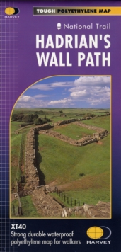
Sheet map, folded
Description
The Way links places associated with the life of the 7th century saint, Cuthbert.
From Melrose Abbey to Holy Island (Lindisfarne). 100km (62 miles). Tough, light and 100% waterproof. Compact and light - the map itself weighs just 60 gms - a third of the weight of a laminated map, and much less bulky. And you can fold or refold it time and again, or put it in your back pocket and it wont fall to pieces.
Shows the entire route on one sheet. Information on finding accommodation, camping and food.
Directions to the start. Also Ranger Service contact numbers and enlargements of towns/villages showing facilities available and tips on weather and clothing.
Information
-
Out of stock
- Format:Sheet map, folded
- Pages:1 pages
- Publisher:Harvey Map Services Ltd
- Publication Date:28/06/2019
- Category:
- ISBN:9781851374748
Information
-
Out of stock
- Format:Sheet map, folded
- Pages:1 pages
- Publisher:Harvey Map Services Ltd
- Publication Date:28/06/2019
- Category:
- ISBN:9781851374748


