John Hancox's Map of the Birmingham Canal Navigations 1864
John Hancox
In Stock - usually despatched within 24 hours
Format: Book (Sheet map, folded)
The Mining & Manufacturing Districts 1836 Staffordshire and Worcestershire
Mapseeker Publishing Ltd.
In Stock - usually despatched within 24 hours
Format: Book (Sheet map, folded)
Samuel Bradford Town Plan Birmingham 1750
Samuel Bradford
In Stock - usually despatched within 24 hours
Format: Book (Sheet map, folded)
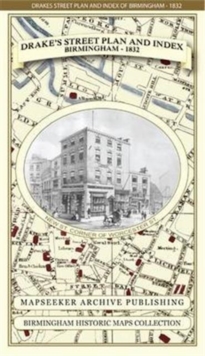
James Drake's Street Plan and Index of Birmingham 1832
James Drake
In Stock - usually despatched within 24 hours
Format: Book (Sheet map, folded)
St Andrews 1854 Map
Peter J. Adams
In Stock - usually despatched within 24 hours
Format: Book (Sheet map)
Swansea (North) 1897 : Glamorgan Sheet 24.01
Steph Mastoris
In Stock - usually despatched within 24 hours
Format: Book (Sheet map, folded)
Map Hanesyddol o Abertawe a Mwmbwls : tref ganoloesol i Copropolis
Matthew Stevens
In Stock - usually despatched within 24 hours
Format: Book (Sheet map, folded)
Liverpool 1650 to 1821 - Fold Up Map Containing Town Plans of Liverpool that include Liverpool 1650, 1725, 1795 and Sherwood's plan of Liverpool and Environs 1821
Mapseeker Publishing Ltd.
In Stock - usually despatched within 24 hours
Format: Book (Sheet map, folded)
Cornwall 1611 - 1836 - Fold Up Map that features a collection of Four Historic Maps, John Speed's County Map 1611, Johan Blaeu's County Map of 1648, Thomas Moules County Map of 1836 and Robert Dawson'
Mapseeker Publishing Ltd.
In Stock - usually despatched within 24 hours
Format: Book (Sheet map, folded)
Hampshire 1610 - 1836 - Fold Up Map that features a collection of Four Historic Maps, John Speed's County Map 1611, Johan Blaeu's County Map of 1648, Thomas Moules County Map of 1836 and a Plan of Win
Mapseeker Publishing Ltd.
In Stock - usually despatched within 24 hours
Format: Book (Sheet map, folded)
Essex 1610 - 1836 - Fold Up Map that features a collection of Four Historic Maps, John Speed's County Map 1610, Johan Blaeu's County Map of 1648, Thomas Moules County Map of 1836 and a Plan of Colches
Mapseeker Publishing Ltd.
In Stock - usually despatched within 24 hours
Format: Book (Sheet map, folded)
Manchester 1650 - 1876 - Fold Up Map featuring William Swire's Plan of Manchester and Environs 1824, Cole and Ropers Plan of Manchester and Salford 1807, Dawson's Reform Plan of 1831, A Birds Eye View
Mapseeker Publishing Ltd.
In Stock - usually despatched within 24 hours
Format: Book (Sheet map, folded)
Derbyshire 1610 - 1836 - Fold Up Map that features a collection of Four Historic Maps, John Speed's County Map 1611, Johan Blaeu's County Map of 1648, Thomas Moules County Map of 1836 and Cole and Rop
Mapseeker Publishing Ltd.
In Stock - usually despatched within 24 hours
Format: Book (Sheet map, folded)
Voie de la Liberte - Michelin Historical Map 105 : Map
Michelin
Out of stock
Format: Book (Sheet map, folded)
Sherlock Holmes Map of London
Aventuras Literarias
Out of Stock - We are unable to provide an estimated availability date for this product
Format: Book (Sheet map, folded)
£9.99
£9.45
Out of Stock - We are unable to provide an estimated availability date for this product
Book (Sheet map, folded)
Add to BasketCentral Birmingham 1888 : Warwickshire Sheet 14.05a
Barrie Trinder
Out of stock
Format: Book (Sheet map, folded)
A Map of Tudor London : The City and Southwark in 1520. Second edition
Caroline Barron
Out of Stock - We are unable to provide an estimated availability date for this product
Format: Book (Sheet map, folded)
£10.99
£9.85
Out of Stock - We are unable to provide an estimated availability date for this product
Book (Sheet map, folded)
Add to BasketCentral Huddersfield 1889 : Yorkshire Sheet 246.15a
Alan Godfrey
Out of stock
Format: Book (Sheet map, folded)
An Historical Map of Oxford: From Medieval to Victorian Times (New Edition)
Alan Crossley
In Stock - usually despatched within 24 hours
Format: Book (Sheet map, folded)
Leeds (NE) 1890 : Yorkshire Sheet 218.02
Alan Godfrey
Out of Stock - We are unable to provide an estimated availability date for this product
Format: Book (Sheet map, folded)
£4.00
Out of Stock - We are unable to provide an estimated availability date for this product
Book (Sheet map, folded)
Add to BasketCheadle and Cheadle Heath 1897 : Cheshire Sheet 19.02
Chris Makepeace
Out of stock
Format: Book (Sheet map, folded)
An Historical Map of York : From Medieval Times to 1850
Peter Addyman
Out of stock
Format: Book (Sheet map, flat)
An Historical Map of Ripon : Cathedral City and Market Town
Mick Stanley
Pre-Order
Format: Book (Sheet map, folded)
An Historical Map of Coventry : From Medieval to Industrial City
Mark Webb
Out of stock
Format: Book (Sheet map, folded)


